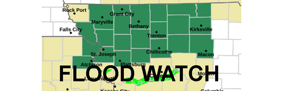
A Flood Watch is issued for much of Northwest and North-central Missouri until Thursday morning. The flood watch area is generally for counties along US 36 and north to the Iowa line. Including Livingston, Linn, Caldwell, Daviess, Grundy, and Sullivan Counties locally.
The National Weather Service says excessive runoff may result in flooding of rivers, creeks, streams, and other low-lying and flood-prone locations. Creeks and streams may rise out of their banks.
Thunderstorms are expected to develop rapidly this afternoon in much of northern Missouri and far northeastern Kansas. Storms will be slow-moving and capable of producing torrential rainfall.
Localized rainfall totals in excess of 3 inches are possible, which may occur in as little as an hour or two. These rainfall totals and rainfall rates will likely lead to instances of flash flooding in the watch area.